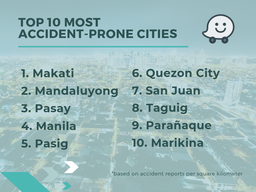
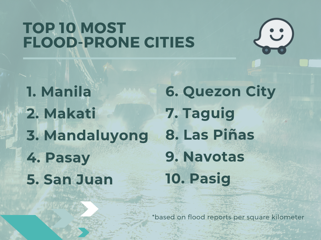
MANILA, PHILIPPINES – The community-based road navigation app, Waze, in collaboration with Thinking Machines, a data science consultancy, today unveiled the ten most accident and flood-prone areas in the Philippines that motorists should watch out for, to encourage road safety and awareness during the rainy season.
Seasoned drivers in the Philippines are always wary of the upcoming rainy season, as the heavy downpours expose drivers to heavier traffic and a higher risk of vehicular accidents. Through data gathered from accident and flood reports per square kilometer in the Philippines since the fourth quarter of 2018, the top ten most accident and flood-prone cities are as follows:


“The data garnered in collaboration with the Thinking Machines indicates that more can be done to encourage road safety and alleviate congestion, and we hope to continually leverage the cooperation of our 2.85 million active user base in the Philippines to help prevent accidents by providing crowdsourced updates on heavy traffic, floods and road closures in real-time,” said Sarah Rodriguez, Country Manager for Waze Philippines.
“Waze data offers a wealth of insight about safety and traffic conditions on our roads. We hope this information can be used to design policies and programs that improve transportation for everyone,” said Stephanie Sy, CEO, Thinking Machines Data Science.
During the rainy season, you may use the Waze app to assist you in navigating heavy traffic while commuting in the Philippines. To report instances of congestion, accidents, flooding, road closures or any other traffic incidents on Waze, download the Waze App on iPhone or Android, launch the app and follow these steps:
- Tap ‘Reports’ (orange button on the bottom right of the screen). This will save your location if you choose to submit the report later.
- Select the report type from the ‘Report’ menu.
- Tap ‘Send’ to share the report.
About Waze
Waze is where people and technology meet to solve transportation challenges. It’s a platform that empowers communities to contribute road data, edit Waze maps, and carpool to improve the way we move about the world. Thanks to Wazers everywhere, Waze is able to partner with municipalities and transit authorities to reduce traffic and congestion—leveraging current infrastructure while impacting city planning. A world with better transportation doesn’t have to be in the distant future. By harnessing the power of community to reverse negative trends in transportation, Waze can create a world where traffic is history.


